Sonoma County's best hikes, with hallmark views of vineyards, oak woodlands and stunning coastal bluffs.
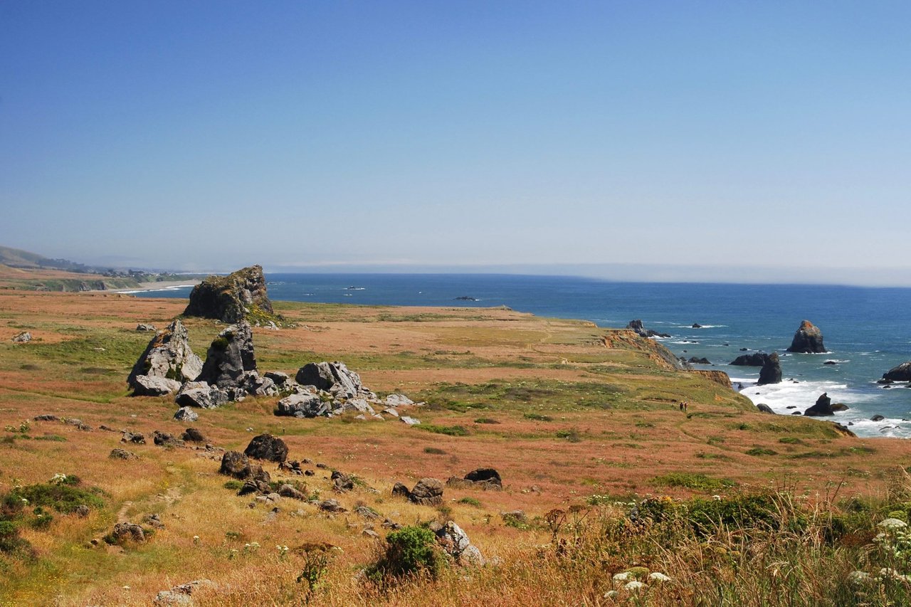
1) Kortum Trail: An absolute classic along the Sonoma coast, winding along the bluff s and headlands from Blind Beach to Wright's Beach, with sightlines all the way to Point Reyes on the clearest days. Where: Park near the end of Goat Rock Road, just south of Jenner and the mouth of the Russian River. Details: 4 miles one-way to Wright's Beach. Make an out-and-back hike of any length you like. Easy and mostly flat. Sonoma Coast State Park, parks.ca.gov.
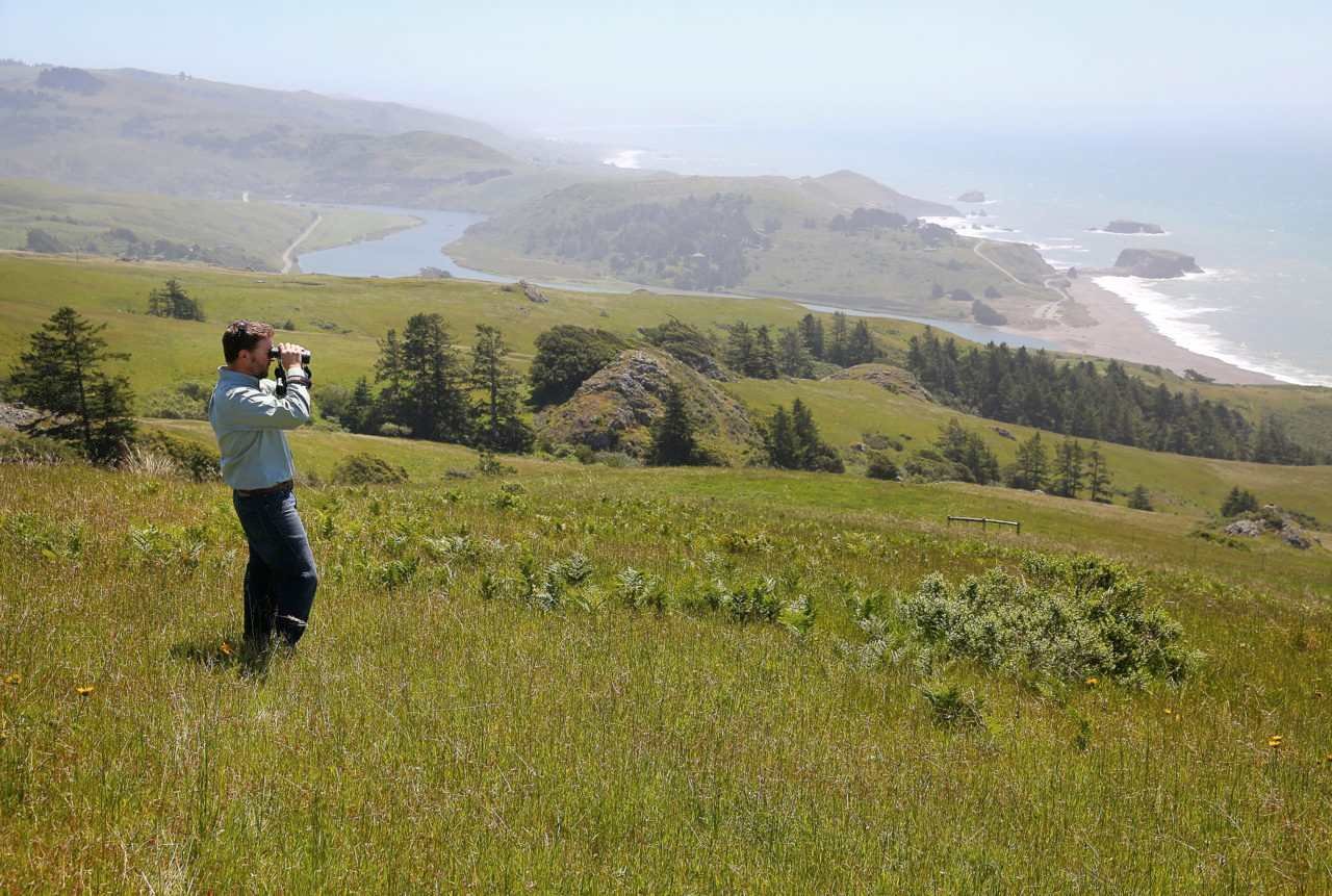
2) Sea to Sky Trail: This unforgettable route takes a serious commitment, as hikers wind through coastal grasslands, oaks, and redwoods up to 360-degree views at the top of Pole Mountain, the highest peak along the Sonoma Coast. The trail debuted in 2018, and our editors make a point to hike it once a year, often on New Year's Day. Where: Start at the parking area in the Jenner Headlands Preserve, along Highway 1 just north of Jenner. Details, Sea to Sky Trail: 15.2 miles round trip with 3,000 feet of climbing. Strenuous uphill; gentle coming back. Sonoma Land Trust, sonomalandtrust.org, Wildlands Conservancy, wildlandsconservancy.org.
3) Mount Saint Helena Summit Trail: A shady first mile gives way to miles along a sunny fi re road to reach the highest peak in Sonoma County, at 4,342 feet. Where: Start on the other side of the ridgeline in Napa, at Robert Louis Stevenson State Park. The trail crosses the county line along the way. Details: 9.3 miles round trip with 2,000 feet of climbing. Strenuous uphill, gentle coming back. Robert Louis Stevenson State Park, parks.ca.gov.
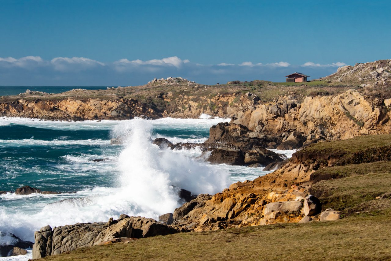
4) Salt Point Trail: The other world-class hike along the Sonoma Coast, along with the Kortum Trail. Views for miles and intricate sandstone rock formations. Winter storms off er a spectacle, with waves crashing against the bluff s below and shooting dozens of feet in the air. Where: Start at the parking lot along Highway 1 at Gerstle Cove, 6 miles north of Fort Ross. Details: 3.2 miles round trip north to Stump Beach and back, easy and mostly flat. Salt Point State Park, parks.ca.gov.
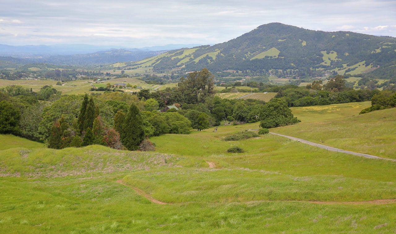
5) Sonoma Overlook Trail: In the town of Sonoma, a short hike beginning at the historic cemetery and switchbacking through meadows and scrub oaks to views of the town and the Mayacamas. The trail begins just a few blocks off the Plaza, but it feels like a world apart. Where: Start at the parking lot for Mountain Cemetery at the end of First St. West. Details: 3 miles round trip. Easy to moderate. overlookmontini.org.
6) Panorama Trail: Petaluma’s Helen Putnam Regional Park is a treasure, and this hike is its jewel, with wide expansive vistas of rolling hills and pockets of live oaks. Especially stunning in March when the hills are green. Where: Start at the parking lot for Helen Putnam Regional Park, along Chileno Valley Road just outside Petaluma via Western Ave. Details: Plenty of loop options and side trails for hikes of diff erent lengths. Moderate. Helen Putnam Regional Park, parks. sonomacounty.ca.gov.
7) North Sonoma Mountain Ridge Trail to Jack London State Park: This hike takes some planning, as it’s an ambitious affair connecting newer trails in the North Sonoma Mountain Regional Park & Preserve to Jack London State Park. Classic Sonoma oak woodlands and grassy hills with views for miles, including from the shoulder of Sonoma Mountain. At the finish, hike past vineyards to tour author Jack London's home and the ruins of his Wolf House. Where: Start at the North Sonoma Mountain Regional Park & Preserve parking lot on Sonoma Mountain Road. Details: 8 miles one way, moderate to strenuous. It's 4 miles from the start to the border of Jack London State Historic Park, then another 4 miles to the fi nish at the entrance to Jack London via the Mountain Trail. Print out maps in advance, and make plans to get a ride back to the start, or take two cars to shuttle back and forth. North Sonoma Mountain Regional Park & Preserve, parks.sonomacounty.ca.gov.
8) Bummer Peak Trail: At Lake Sonoma, past the Warm Springs Dam in the Rockpile region, this trail meanders through oaks, madrones, and grasslands to top out at a 1,100-foot knoll with stunning overlooks of the lake. This hike is best in spring. Where: Pick up a map at the Lake Sonoma visitor center in Geyserville, then head west over the bridge to Rockpile Road and park at the Little Flat parking area on the right. Details: 4.7 miles round trip. Moderate. US Army Corps of Engineers, spn.usace.army.mil/Missions/Recreation/Lake-Sonoma.
9) Vista Trail Loop: In Sugarloaf Ridge State Park, this route skirts the edge of the Mayacamas Mountains that separate Sonoma from Napa. Much of the route burned in 2017, off ering a portrait of nature’s resilience. The trail is especially beautiful in the early morning or close to sunset. For a more strenuous hike, add on the loop to the summit of Bald Mountain and return to the start via the Grey Pine Trail. Where: Start in Sugarloaf Ridge State Park in Kenwood, at the end of Adobe Canyon Road. Details: 4.1 miles round trip, moderate. sugarloafpark.org.
10) Two other all-star Sonoma hikes are the loop through historic redwood groves in Armstrong Redwoods State Natural Reserve near Guerneville (pictured) and the trail to Gunsight Rock in Sonoma Valley’s Hood Mountain Regional Park. Both were closed due to wildfires but reopened in 2021.